- Data Collection
- Asset inventory + condition assessment
- Accurate, itemized, and actionable data
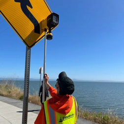
- Collected by boots-on-the-ground technicians
We collect actionable GIS data and enable public agencies to effectively manage their right-of-way infrastructure and achieve compliance.
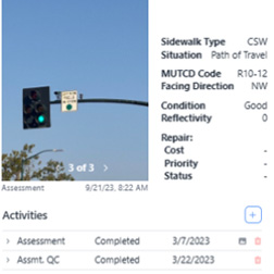
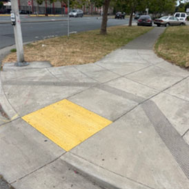
Type, dimensions, slopes, condition, compliance.
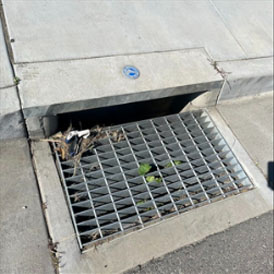
Type, cleanliness, condition, compliance.
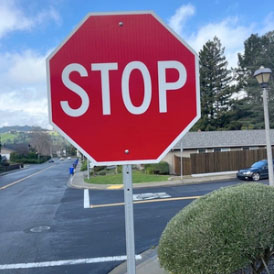
Retro reflectivity, direction, clearance, MUTCD Code, dimension, condition, compliance.

Type, height, metal thickness, condition, compliance.
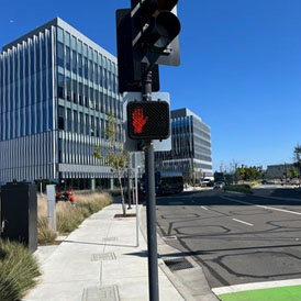
Type, height, metal thickness, condition, compliance.
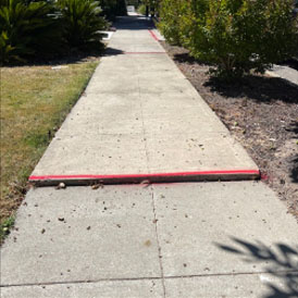
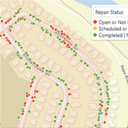
Condition assessments, ADA compliance deficiencies, recommended repair or maintenance treatments.
We use proprietary desktop and mobile software specifically designed for right-of-way asset management and compatible with any GIS / CMMS software.
Our software is simple and easy to use. It is fully configured and operational within seconds on any devices.
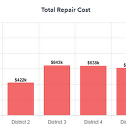
It leverages state-of-the-art technology and actionable data to provide powerful analytics, facilitate astute budgeting, and enable effective workflow management.